پرونده:Somalia pol02.jpg

این پیش-پیش سِراق هدائن ِقایده: ۵۰۰ × ۵۹۹ پیکسل. دیگه کیفیتون: ۲۰۰ × ۲۴۰ پیکسل | ۴۰۰ × ۴۸۰ پیکسل | ۶۴۱ × ۷۶۸ پیکسل | ۱٬۰۷۸ × ۱٬۲۹۲ پیکسل.
اصلی پرونده (۱٬۰۷۸ × ۱٬۲۹۲ پـیـکـسهل, فـایـل گـأتـی: ۶۹۸ کیلوبایت, MIME مـونـد: image/jpeg)
|
|
این پرونده ویکیتلمبار دله دَره. ونه دلهی بنویشتهئون (مازرونی) ره اینجه سِراق دنه. |
کار ِگزارش
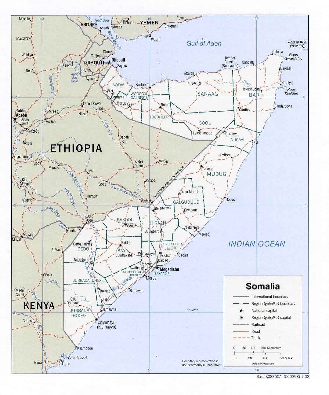
Perry-Castañeda Library - Political map of Somalia.
According to the source's table of contents, this is a CIA map, thus placing the image in the public domain.
اجازهنومه
| This image is a work of a Central Intelligence Agency employee, taken or made as part of that person's official duties. As a Work of the United States Government, this image or media is in the public domain in the United States.
|

|
فایل تاریخچه
تاریخ/زمونها سَر کلیک هاکنین تا اون گدِر ِنسخه ره هارشین.
| تاریخ/زمون | انگوسگتی | ابعاد | کارور | توضیح | |
|---|---|---|---|---|---|
| إسا | ۱۶ مارس ۲۰۱۹، ساعت ۱۷:۵۵ | | ۱٬۰۷۸ در ۱٬۲۹۲ (۶۹۸ کیلوبایت) | Goran tek-en | Changed Giohar to Jowhar and added Adado as requested by {{u|Buckshot06}} |
| ۱۴ دسامبر ۲۰۰۵، ساعت ۰۷:۴۷ |  | ۱٬۰۷۸ در ۱٬۲۹۲ (۲۰۲ کیلوبایت) | Gyrofrog | Political map of Somalia.<br /> According to the source's [http://www.lib.utexas.edu/maps/somalia.html table of contents], this is a CIA map, thus placing the image in the public domain. |
پروندهی استفاده
این صفحه لینک هِدانه این فایل ره:
پروندهیِ گِردِ استفادهئون
این ویکیون هم این پرونده جه استفاده کانّه:
- کاربرد ast.wikipedia.org دله
- کاربرد bg.wikipedia.org دله
- کاربرد ckb.wikipedia.org دله
- کاربرد en.wikipedia.org دله
- کاربرد fa.wikipedia.org دله
- کاربرد fi.wikipedia.org دله
- کاربرد id.wikipedia.org دله
- کاربرد ja.wikipedia.org دله
- کاربرد lt.wikipedia.org دله
- کاربرد nl.wikipedia.org دله
- کاربرد ru.wikipedia.org دله
- کاربرد sk.wikipedia.org دله
- کاربرد tg.wikipedia.org دله
- کاربرد uk.wikipedia.org دله