پرونده:Mediterranean Sea political map-es.svg

حجم پیشنمایش PNG این SVG file:۸۰۰ × ۵۸۵ پیکسل دیگه کیفیتون: ۳۲۰ × ۲۳۴ پیکسل | ۶۴۰ × ۴۶۸ پیکسل | ۱٬۰۲۴ × ۷۴۹ پیکسل | ۱٬۲۸۰ × ۹۳۶ پیکسل | ۲٬۵۶۰ × ۱٬۸۷۲ پیکسل | ۲٬۰۴۶ × ۱٬۴۹۶ پیکسل.
اصلی پرونده (اسویجی ِپرونده، ابعاد ۲٬۰۴۶ × ۱٬۴۹۶ پیکسل جه، پرونده قایده: ۱٫۱ مگابایت)
|
|
این پرونده ویکیتلمبار دله دَره. ونه دلهی بنویشتهئون (مازرونی) ره اینجه سِراق دنه. |
| توضیح |
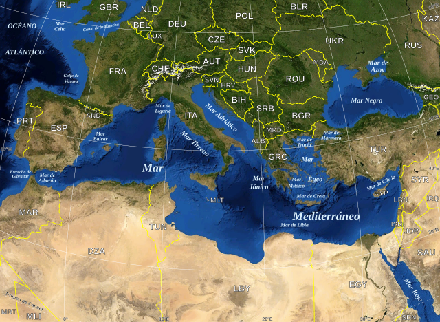
English: Map in Spanish of the Mediterranean Sea, with the borders and the name of the States following the ISO 3166-1 Alpha-3 code. Español: Mapa en español del Mar Mediterraneo con las fronteras y los nombres de los estados siguiendo el código ISO 3166-1 Alpha-3. |
| تاریخ | (UTC) |
| منبع | |
| سازنده |
|
| این یک عکس دستکاری شده است به این معنی که به صورت دیجیتالی از نسخهٔ اصلی تغییر یافتهاست. تغییرها: Versión en español. اصل آن را میتوان در اینجا مشاهده کرد: Mediterranean Sea political map-en.svg. تغییرها توسط Edoarado انجام شدهاست.
|
| این تصویر در مالکیت عمومی قرار دارد به این دلیل که از نرمافزار زمین ناسا World Wind با استفاده یک لایهٔ مالکیت عمومی، از قبیل Blue Marble، MODIS، Landsat، SRTM، USGS یا GLOBE گرفته شده است.
|
 |
| This work was previously under Public Domain, or a Free License. It has been digitally enhanced and/or modified. This derivative work has been (or is hereby) released into the public domain by its author, [[:{{{1}}}:User:{{{3}}}|{{{3}}}]] at the [[:{{{1}}}:|{{{2}}}]] project. This applies worldwide. In some countries this is not legally possible; if so:
|
سیاهه بارگذاری اصلی
This image is a derivative work of the following images:
- File:Mediterranean_Sea_political_map-en.svg licensed with PD-WorldWind, PD-retouched-user-w
- 2008-05-19T16:18:12Z Sting 2046x1496 (1148854 Bytes) "Tropic of Cancer" label correction
- 2007-06-21T01:01:36Z Sting 2046x1496 (1148419 Bytes) {{Information |Description=Map in English of the [[:en:Mediterranean Sea|Mediterranean Sea]], with the borders and the name of the States following the ISO 3166-1 Alpha-3 code. |Source=Own work ;Background map : screenshot fr
Uploaded with derivativeFX
فایل تاریخچه
تاریخ/زمونها سَر کلیک هاکنین تا اون گدِر ِنسخه ره هارشین.
| تاریخ/زمون | انگوسگتی | ابعاد | کارور | توضیح | |
|---|---|---|---|---|---|
| إسا | ۱۳ ژوئن ۲۰۱۰، ساعت ۱۸:۳۲ | | ۲٬۰۴۶ در ۱٬۴۹۶ (۱٫۱ مگابایت) | Edoarado | Corregido error en "Océano Atlántico", el texto aparecía del revés. |
| ۱۳ ژوئن ۲۰۱۰، ساعت ۱۸:۱۶ |  | ۲٬۰۴۶ در ۱٬۴۹۶ (۱٫۱ مگابایت) | Edoarado | {{Information |Description={{en|Map in Spanish of the Mediterranean Sea, with the borders and the name of the States following the ISO 3166-1 Alpha-3 code.}} {{es|Mapa en español del Mar Mediterraneo con |
پروندهی استفاده
این صفحه لینک هِدانه این فایل ره:
پروندهیِ گِردِ استفادهئون
این ویکیون هم این پرونده جه استفاده کانّه:
- کاربرد ar.wikipedia.org دله
- کاربرد arz.wikipedia.org دله
- کاربرد ast.wikipedia.org دله
- کاربرد ca.wikipedia.org دله
- کاربرد el.wikipedia.org دله
- کاربرد en.wikipedia.org دله
- کاربرد es.wikipedia.org دله
- کاربرد eu.wikipedia.org دله
- کاربرد fi.wiktionary.org دله
- کاربرد fr.wikinews.org دله
- کاربرد ga.wikipedia.org دله
- کاربرد gl.wikipedia.org دله
- کاربرد ha.wikipedia.org دله
- کاربرد ia.wikipedia.org دله
- کاربرد kab.wikipedia.org دله
- کاربرد la.wikipedia.org دله
- کاربرد pnb.wikipedia.org دله
- کاربرد pt.wikipedia.org دله
- کاربرد shi.wikipedia.org دله
- کاربرد vec.wikipedia.org دله
- کاربرد www.wikidata.org دله